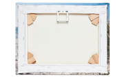
 No city has changed so much over the last hundred years as Rotterdam. Already in the 1930's the city planners started making breakthroughs in the medieval center of the city. The German Luftwaffe did a more thorough job in 1940: in the bombing on the 14th of May, the old city was almost completely destroyed.
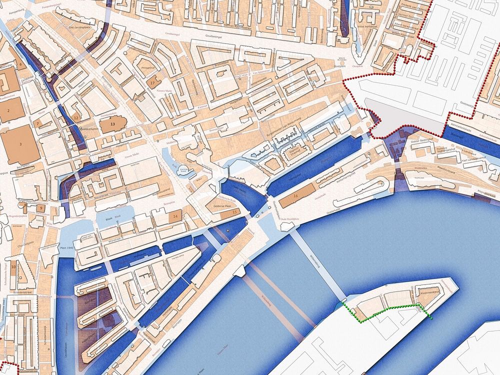
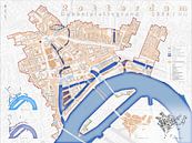
The Basic Plan for the Reconstruction by Cornelis van Traa laid the foundation for an entirely new city. The pre-war city was not rebuilt and the street plan was changed drastically, apart from a few important lines like Coolsingel, Goudsesingel and Binnenrotte. As a result, you can say that in Rotterdam there are in fact two cities, separated by time.
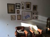
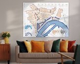
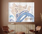
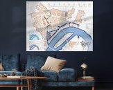
This double plan 1939/Now shows those two cities. The large blocks of modern Rotterdam are projected over the finely meshed pre-war town. Also the change in the watercourses is visible. The map also demonstrates how many old streetnames returned in the new city, although often on rather different locations.
The map includes the area within the fire limits of May 1940. Also the attachment points between the old and the new city are indicated the 19 buildings that not only survived the bombing but also the postwar demolition drive.
This artwork is offered by Frans Blok
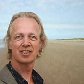
My work can be located in the border regions of photography, painting and computer visuals. With my company 3Develop I do work in commission but I use the same techniques, skills and software to make free work. I am originally an architect and I live in Rotterdam; for that reason the architecture of that city is a major (but not the only) source of inspiration. But also travel to countries like Iceland and Britain, or walks in the Netherlands, provide much material. Seeing and showing quality and beauty, that is what my work is about.
Learn more about Frans Blok?
Customer reviews
This artwork doesn't have reviews yet.
3,729 customer rate us with a 4.7 / 5
 Germany
 Ordered in May 2021
Germany
Ordered in November 2021
Ordered in May 2021
Germany
Ordered in November 2021
 Netherlands
 Ordered in October 2020
Germany
Ordered in March 2023
Germany
Ordered in January 2021
Germany
Ordered in December 2022
Netherlands
Ordered in November 2019
Netherlands
Ordered in August 2019
Netherlands
Ordered in December 2021
Germany
Ordered in April 2021
Germany
Ordered in October 2022
Germany
Ordered in January 2020
Ordered in October 2020
Germany
Ordered in March 2023
Germany
Ordered in January 2021
Germany
Ordered in December 2022
Netherlands
Ordered in November 2019
Netherlands
Ordered in August 2019
Netherlands
Ordered in December 2021
Germany
Ordered in April 2021
Germany
Ordered in October 2022
Germany
Ordered in January 2020
Pros and cons
- Thick photo paper
- Fine-art quality
- Frame the poster yourself
- Not mountable without a frame
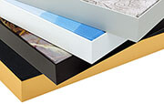
High quality art prints
Photoprints are printed on 260 grams heavy photo paper. Your favorite artworks are printed on the best printers with UV-protected inks. The print will not fade.
Learn more?
You will find more about Poster and the other materials at: