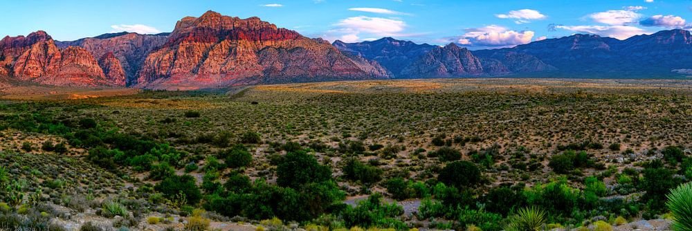

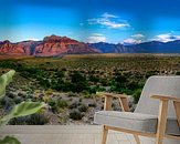


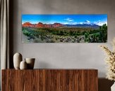


 The Red Rock Canyon National Conservation Area in Clark County, Nevada, is an area managed by the Bureau of Land Management as part of its National Landscape Conservation System, and protected as a National Conservation Area. It is about 15 miles (24 km) west of Las Vegas, and is easily seen from the Las Vegas Strip. More than two million people visit the area each year.[2]
The conservation area showcases a set of large red rock formations: a set of sandstone peaks and walls called the Keystone Thrust. The walls are up to 3,000 feet (910 m) high, making them a popular hiking and rock climbing destination. The highest point is La Madre Mountain, at 8,154 feet (2,485 m).
A one-way loop road, 13 miles (21 km) long, provides vehicle access to many of the features in the area. Several side roads and parking areas allow access to many of the area trails. A visitor center is at the start of the loop road. The loop road is also popular for bicycle touring; it begins with a moderate climb, then is mostly downhill or flat.
Red Rock Canyon is a side-canyon accessible only by an unmaintained primitive road from the scenic loop which mostly only off-road or high clearance vehicles can access. State Route 159 cuts through an unnamed but often-visited valley; it is commonly, but mistakenly, referred to as Red Rock Canyon. The Wilson Cliffs, or Keystone Thrust, a massive wall of rock, can be seen to the west from SR 159.
Toward the southern end of the National Conservation Area a
This artwork is offered by Remco Bosshard
Normally I take photo's of (large) objects for customers, but another big passion is photographing beautiful landscapes. Anything beautiful might be something I would capture in my frame.
Learn more about Remco Bosshard?
Customer reviews
This artwork doesn't have reviews yet.
3,729 customer rate us with a 4.7 / 5
 Netherlands
 Ordered in October 2018
 Germany
 Ordered in August 2022
Germany
Ordered in March 2019
Netherlands
Ordered in May 2021
Netherlands
Ordered in December 2021
Netherlands
Ordered in August 2020
Netherlands
Ordered in April 2023
Germany
Ordered in January 2021
Germany
Ordered in February 2021
Germany
Ordered in March 2023
Netherlands
Ordered in May 2017
Germany
Ordered in February 2021
Ordered in August 2022
Germany
Ordered in March 2019
Netherlands
Ordered in May 2021
Netherlands
Ordered in December 2021
Netherlands
Ordered in August 2020
Netherlands
Ordered in April 2023
Germany
Ordered in January 2021
Germany
Ordered in February 2021
Germany
Ordered in March 2023
Netherlands
Ordered in May 2017
Germany
Ordered in February 2021

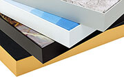
Pros and cons
- Tack sharp prints
- Mounted on sustainable, PEFC-approved wood
- Optionally available with a floater frame
- No acoustic function
- Not changeable
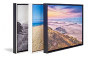
A classic and everlasting material
Art prints on canvas fit in any room and style. Finish the canvas print by adding a wooden floater frame.
Canvas paintings and photographic prints by Art Heroes are printed on white cotton canvas in the highest quality. The canvas print is mounted on sustainable PEFC-approved wood.
Learn more?
You will find more about Canvas and the other materials at: