
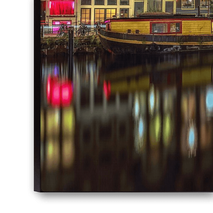


Buy the photo Singel Amsterdam @ night by Michael van der Burg on canvas, ArtFrame, poster and wallpaper, printed on demand in high quality.
About "Singel Amsterdam @ night"
by Michael van der Burg
About the artwork
The (Amsterdam: het) Singel is an Amsterdam canal, running from the IJ to the Muntplein, where it flows into the Binnen Amstel. History The Singel was dug from the IJ to the Boerenwetering around 1428. The remaining part to the Amstel followed around 1450. Until the city enlargement of around 1585, the Singel formed the western city boundary. From 1481, the earthen wall was replaced by a stone wall. At that time, the Singel was also called Stedegracht. Today, this Stedegracht still consists of the present Singel, Kloveniersburgwal and Geldersekade. In the 17th century, the Singel was temporarily called Koningsgracht in honour of King Henry IV of France, an important ally of the Republic at the time. Koningsplein is a reminder of this. The part of the Singel from the Round Lutheran Church to Lijnbaanssteeg where the ships bound for London, the 'Londoners', had their berths, was also called Londense Kaai and Engelse Kaai. Part of the Geldersekade was also called Londonse Kaai or English Kaai. Between Lijnbaanssteeg and Torensluis, the Singel was called Rouaansche Kaai, because of the navigation on Het Kanaal. The Torensluis from 1648 is the oldest preserved and the widest bridge in the entire city centre. This Bridge 9 - at the level of Oude Leliestraat - is so wide because the Jan Roodenpoort tower, demolished in 1829, stood here. The tower's dungeons are still part of the bridgehead. In the cobblestones on the bridge are
About Michael van der Burg
Welcome!.. Read more…
 Amsterdam
 City centre of Amsterdam
 Night photography
 North Holland
 Photo wallpaper
 Photography
 Reflections
 Romantic Moments
 Serene Peace
 Singels
 The Netherlands
 Netherlands
 Ordered in December 2021
 Germany
 Ordered in June 2020
Netherlands
Ordered in June 2020
Netherlands Ordered in March 2024
Germany
Ordered in November 2020
Netherlands
Ordered in November 2021
Netherlands
Ordered in December 2021
Netherlands
Ordered in June 2019
Netherlands
Ordered in October 2020
Netherlands
Ordered in June 2021
Germany
Ordered in March 2024
Germany
Ordered in May 2021
Germany
Ordered in June 2022
Ordered in March 2024
Germany
Ordered in November 2020
Netherlands
Ordered in November 2021
Netherlands
Ordered in December 2021
Netherlands
Ordered in June 2019
Netherlands
Ordered in October 2020
Netherlands
Ordered in June 2021
Germany
Ordered in March 2024
Germany
Ordered in May 2021
Germany
Ordered in June 2022
About the material
ArtFrame™
Interchangeable Art Prints
- High-quality print
- Easily interchangeable
- Acoustic function
- Large sizes available


Discover the artworks of Michael van der Burg
 Erasmus Bridge Evening from the WillemskadeMichael van der Burg
 Rotterdam Panorama Rijnhaven ViewMichael van der Burg
 Skyline Rotterdam Rijnhaven viewMichael van der Burg
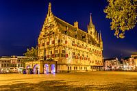 Gouda Town Hall rear viewMichael van der Burg
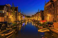 Turfmarkt GoudaMichael van der Burg
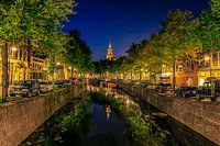 West and Oosthaven GoudaMichael van der Burg
 B&W Erasmus bridge LeuvehoofdMichael van der Burg
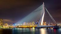 Erasmus BridgeMichael van der Burg
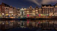 Singel Red Light DistrictMichael van der Burg
 Old Rhine LeidenMichael van der Burg
 Leiden American Pilgrim MuseumMichael van der Burg
 Koppelpoort Sunset AmersfoortMichael van der Burg
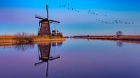 reflection KinderdijkMichael van der Burg
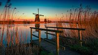 Kinderdijk HollandMichael van der Burg
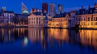 Hofvijver The HagueMichael van der Burg
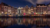 Amsterdam Red LightsMichael van der Burg
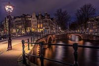 Keizersgracht AmsterdamMichael van der Burg
 Zaanse SchansMichael van der Burg
 Tulips Sunset HollandMichael van der Burg
 Behind the Church DelftMichael van der Burg


