


Buy the photo The Katla and Mýrdalsjökull glaciers in Iceland by KC Photography on canvas, ArtFrame, poster and wallpaper, printed on demand in high quality.
About "The Katla and Mýrdalsjökull glaciers in Iceland"
by KC Photography
About the artwork
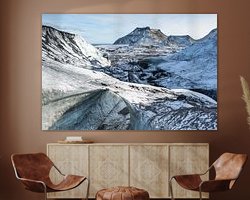
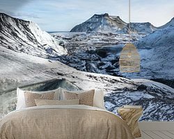
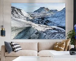
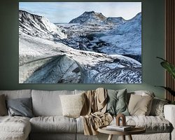
The Katla volcano and the Mýrdalsjökull glacier in Iceland. The Mýrdalsjökull is a glacier in southern Iceland just north of the town of Vík í Mýrdal and east of the smaller glacier Eyjafjallajökull. Its highest peaks reach a height of up to 1493 metres and its total area was still 595 km² in 1980. The ice cap of the glacier covers the active volcano Katla. The crater of the volcano has a diameter of 10 km and the volcano erupts every 40-80 years. As the last eruption dates from 1918, scientists keep a close eye on the volcano. Since 930, 16 eruptions have been recorded. The Laki craters and the Eldgjá belong to the same volcanic system.

About KC Photography
Kris Christiaens is a professional aviation photographer who always tries to portray the power, manoeuvrability and history of aircraft and helicopters in the most original and impressive way possible... Read more…
 Glaciers
 Ice
Ice Iceland
 Mountains
 Mysterious Spheres
 Photo wallpaper
 Photography
 Serene Peace
 Volcanoes
 Germany
 Ordered in November 2020
Germany
Ordered in September 2019
Ordered in November 2020
Germany
Ordered in September 2019
 Netherlands
 Ordered in December 2021
Netherlands
Ordered in December 2021
Netherlands Ordered in January 2025
Germany
Ordered in March 2025
Germany
Ordered in June 2020
Netherlands
Ordered in January 2019
Netherlands
Ordered in December 2017
Germany
Ordered in May 2019
Netherlands
Ordered in October 2017
Germany
Ordered in March 2022
Germany
Ordered in July 2019
Ordered in January 2025
Germany
Ordered in March 2025
Germany
Ordered in June 2020
Netherlands
Ordered in January 2019
Netherlands
Ordered in December 2017
Germany
Ordered in May 2019
Netherlands
Ordered in October 2017
Germany
Ordered in March 2022
Germany
Ordered in July 2019
About the material
ArtFrame™
Interchangeable Art Prints
- High-quality print
- Easily interchangeable
- Acoustic function
- Large sizes available


Discover the artworks of KC Photography
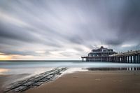 Pier BlankenbergeKC Photography
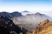 Foggy mountain landscapeKC Photography
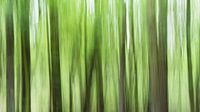 Dark treesKC Photography
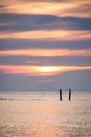 Sunset birdsKC Photography
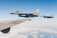 Dutch vipersKC Photography
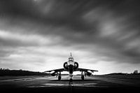 Old Mirage 5 under dark cloudsKC Photography
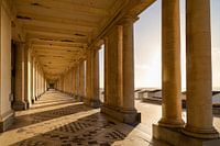 Royal Galleries of OstendKC Photography
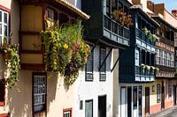 Santa Cruz de la PalmaKC Photography
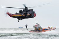 Sea King rescue helicopterKC Photography
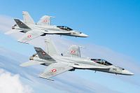 Swiss Air Force in actionKC Photography
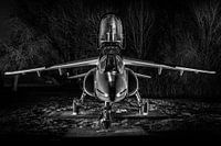 Alpha Jet at nightKC Photography
 The art of glidingKC Photography
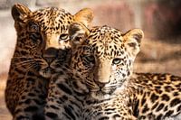 Leopard eyesKC Photography
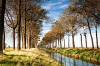 Spring by the canalKC Photography
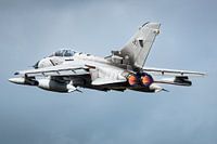 Tornado afterburnerKC Photography
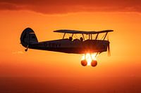 Flying at sunsetKC Photography
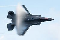 F-35 Lightning IIKC Photography
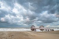 MiddelkerkeKC Photography
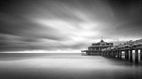 The famous Pier of BlankenbergeKC Photography
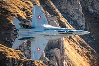 Swiss F-18 flies through the AlpsKC Photography


