


About ‘Visually dramatic world map, 1630’ by Nic Limper
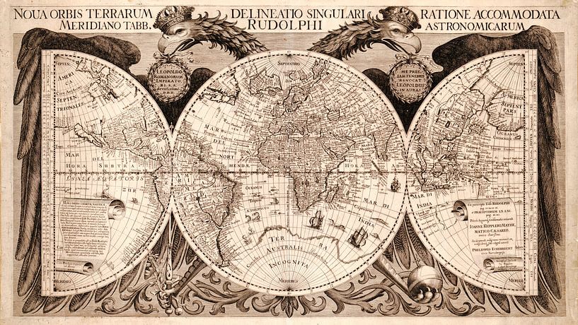
"Nova Orbis Terrarum Delineatio Singulari Ratione Accommodata Meridiano Tabb. Rudolphi Astronomicarum.", ancient world map from 1630, made by Philippus Eckebrecht.
The map is one of the most visually dramatic world maps, dominated by the German Imperial double-headed eagle holding all the world in its wings, an allegory…
Colors
Discover our ArtFrame
The modern canvas alternative
Your chosen art on a textile print, stretched in an aluminum or wooden frame. Quick and easy to change for a fresh look and exactly as you want it.
- High-quality print
- Easily replaceable
- Acoustic function
- Large formats possible

Discover the artworks of Nic Limper


Customer reviews
4.8/5

Related collections