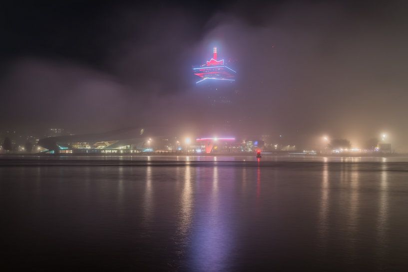


Buy the photo Fog in dark Amsterdam - part 3: A'DAM Tower by Jeroen de Jongh Photography on canvas, ArtFrame, poster and wallpaper, printed on demand in high quality.
About "Fog in dark Amsterdam - part 3: A'DAM Tower"
by Jeroen de Jongh Photography
About the artwork
The IJ is a river, formerly an estuary, in North Holland. The actual IJ or Binnen-IJ separates the Amsterdam city centre from Amsterdam North, and was originally an offshoot of the Zuiderzee. The name IJ is related to the (West-)Frisian Ae, Ee or Die. This means 'water'.
There are several theories about the origin of the IJ. Possibly the IJ started as a creek, as a result of a breach in the dunes near Castricum. More likely, the IJ is a remnant of a northern arm of the Rhine delta. Finally, the IJ could also have originated from the neighbouring city of Almere. Whatever the case, during Roman times the Oer-IJ formed the connection between Almere and the Utrecht Vecht on the one hand, and the North Sea on the other. The connection to the North Sea later disappeared, while in the Middle Ages the IJ became increasingly wider. This was related to the creation of the Zuiderzee, itself the result of a number of storm surges (such as the Allerheiligen flood).
In the Middle Ages, dikes were built along the IJ: on the south side of the Amstel in eastern direction the Sint Antoniesdijk (later replaced by the Hoogte Kadijk), the Zeeburgerdijk and the Diemerzeedijk. To the west are the Haarlemmerdijk and Spaarndammerdijk. On the north side lies the Noorder IJdijk. At the end of the Middle Ages, dike villages arose along this dike, from east to west: Durgerdam, Schellingwoude, Nieuwendam, and Buiksloot.
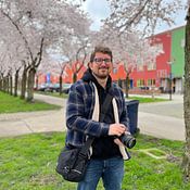
About Jeroen de Jongh Photography
I'm Jeroen, and I'll spare you the long introduction. ;) If you're looking for a landscape photo for your wall, you've come to the right place... Read more…
 Amsterdam
 Amsterdam Central Station
 City centre of Amsterdam
 Europe
 Fog
Fog Mysterious Spheres
 North Holland
 Photo wallpaper
 Photography
 Serene Peace
 The Netherlands
 Netherlands
 Ordered in June 2019
 Netherlands
Ordered in October 2019
Netherlands
Ordered in October 2019
 Germany
 Ordered in April 2025
Netherlands
Ordered in October 2021
Netherlands
Ordered in April 2021
Netherlands
Ordered in April 2025
Netherlands
Ordered in October 2021
Netherlands
Ordered in April 2021
Netherlands Ordered in April 2024
Germany
Ordered in August 2023
Germany
Ordered in April 2021
Germany
Ordered in April 2024
Germany
Ordered in September 2023
Netherlands
Ordered in November 2021
Netherlands
Ordered in August 2021
Ordered in April 2024
Germany
Ordered in August 2023
Germany
Ordered in April 2021
Germany
Ordered in April 2024
Germany
Ordered in September 2023
Netherlands
Ordered in November 2021
Netherlands
Ordered in August 2021
About the material
ArtFrame™
Interchangeable Art Prints
- High-quality print
- Easily interchangeable
- Acoustic function
- Large sizes available


Discover the artworks of Jeroen de Jongh Photography
 Full moon at the flower marketJeroen de Jongh Photography
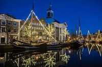 Lange HavenJeroen de Jongh Photography
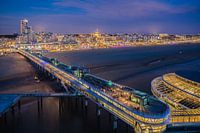 Scheveningen PierJeroen de Jongh Photography
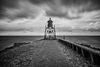 Lighthouse StavorenJeroen de Jongh Photography
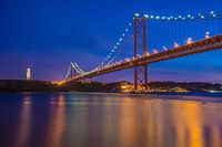 April 25th BridgeJeroen de Jongh Photography
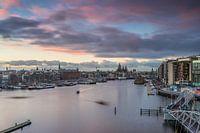 OosterdokJeroen de Jongh Photography
 Climb to the lightJeroen de Jongh Photography
 MonnickendamJeroen de Jongh Photography
 Zonnepad MonnickendamJeroen de Jongh Photography
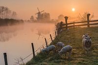 Mill de Vlinder on a misty morning in the BetuweJeroen de Jongh Photography
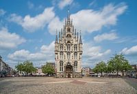 Town Hall of Gouda at the MarketJeroen de Jongh Photography
 Swans at the skyline of ZutphenJeroen de Jongh Photography
 Quiet autumn morning in the park of Groeneveld CastleJeroen de Jongh Photography
 Magical sunrise at the Amstelveense PoelJeroen de Jongh Photography
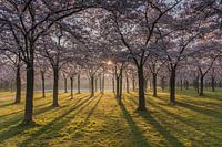 Sunrise in the cherry blossom park of the Amsterdamse BosJeroen de Jongh Photography
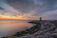 Sunset at the IJmuiden PierJeroen de Jongh Photography
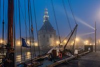 Hoorn's Hoofdtoren in the mistJeroen de Jongh Photography
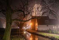 Rocking in foggy RansdorpJeroen de Jongh Photography
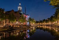 Peace and quiet at Schiedam's Lange HavenJeroen de Jongh Photography
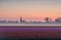 Tulip field, fog bank, church, colourful horizonJeroen de Jongh Photography


