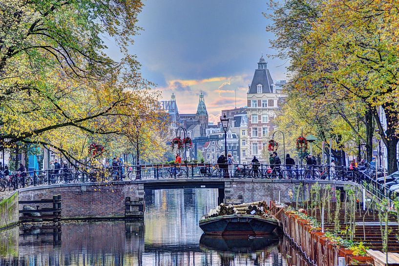


Buy the photo Amsterdam Kloveniersburgwal Centre towards Amstel by Hendrik-Jan Kornelis on canvas, ArtFrame, poster and wallpaper, printed on demand in high quality.
About "Amsterdam Kloveniersburgwal Centre towards Amstel"
by Hendrik-Jan Kornelis
About the artwork
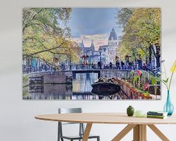
The Kloveniersburgwal (Kloveniers city wall) was dug at the end of the 15th century, from the Sint Antoniespoort (now the Weigh House on the Nieuwmarkt) to the south, where it ended in the Amstel. On the city side (the west side) a city wall was built, with three small wall towers and the large wall tower: Swych Utrecht (1481). The wall was mainly bordered by gardens and orchards, and the Bethaniënklooster. This can be clearly seen on the bird's eye map by Cornelis Anthonisz. of 1544. Together with the Geldersekade and the Singel, the Kloveniersburgwal formed the city canal around the city.
About Hendrik-Jan Kornelis
As a child, there was already a predilection for visual art. As a technician, I was always creative in products, services and working methods. In later years, more time was taken for my art (photography) passion... Read more…
 Amsterdam
 Boats & Ships
 Bridges
 Canal house
 Canals
 High Dynamic Range
 Nostalgic Memories
 Photo wallpaper
 Photography
 Romantic Moments
 Serene Peace
 Street photography
 The Netherlands
 Trees
Trees Vibrant Colors
 Water
Water Germany
 Ordered in March 2019
 Netherlands
 Ordered in May 2024
Netherlands
Ordered in December 2024
Germany
Ordered in September 2020
Germany
Ordered in June 2019
Germany
Ordered in June 2022
Netherlands
Ordered in May 2024
Netherlands
Ordered in December 2024
Germany
Ordered in September 2020
Germany
Ordered in June 2019
Germany
Ordered in June 2022
Netherlands Ordered in November 2019
Netherlands
Ordered in April 2023
Netherlands
Ordered in June 2019
Germany
Ordered in March 2022
Germany
Ordered in June 2020
Germany
Ordered in May 2021
Ordered in November 2019
Netherlands
Ordered in April 2023
Netherlands
Ordered in June 2019
Germany
Ordered in March 2022
Germany
Ordered in June 2020
Germany
Ordered in May 2021
About the material
ArtFrame™
Interchangeable Art Prints
- High-quality print
- Easily interchangeable
- Acoustic function
- Large sizes available


Discover the artworks of Hendrik-Jan Kornelis
 Prinsengracht 322 AmsterdamHendrik-Jan Kornelis
 Westerkerk Amsterdam with boatHendrik-Jan Kornelis
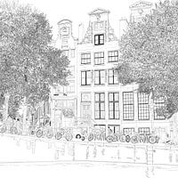 Pen Drawing Herengracht 392 Amsterdam SquareHendrik-Jan Kornelis
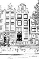 Drawing Brouwersgracht 48 AmsterdamHendrik-Jan Kornelis
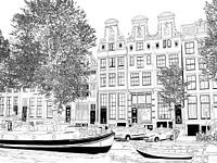 Drawing Herengracht 51-65 AmsterdamHendrik-Jan Kornelis
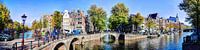 Panorama Leidsegracht / Keizersgracht AmsterdamHendrik-Jan Kornelis
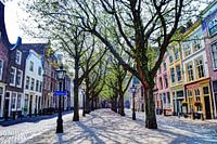 Hooglandse Kerkgracht Leiden The NetherlandsHendrik-Jan Kornelis
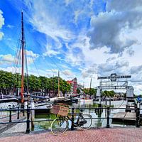 Nieuwe Haven Dordrecht NetherlandsHendrik-Jan Kornelis
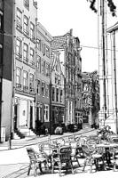 Noordermarkt Drawing AmsterdamHendrik-Jan Kornelis
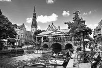 Drawing of City Hall and Kroonbrug Leiden NetherlandsHendrik-Jan Kornelis
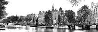 Pen drawing Southern church Amsterdam KloveniersburgwalHendrik-Jan Kornelis
 Hoorn Noord-Holland The Netherlands PortHendrik-Jan Kornelis
 Panorama Hoorn Oude Haven Kruittoren North Holland NetherlandsHendrik-Jan Kornelis
 Cinque Terre Tuscany Italy OldHendrik-Jan Kornelis
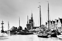 Hoorn Port North Holland Netherlands Black and WhiteHendrik-Jan Kornelis
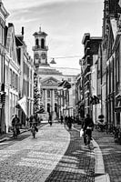 Town hall of Dordrecht Netherlands Black and WhiteHendrik-Jan Kornelis
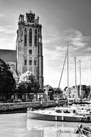 Our Lady Church in Dordrecht Netherlands Black and WhiteHendrik-Jan Kornelis
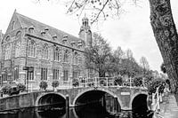 Nonnenbrug with Academy building Leiden Netherlands Black and whiteHendrik-Jan Kornelis
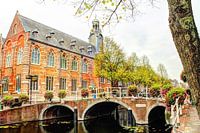 Nonnenbrug with Academy Building Leiden NetherlandsHendrik-Jan Kornelis
 Jordaan Amsterdam Netherlands Black and WhiteHendrik-Jan Kornelis


