


Buy this of Rotterdam Double street map Rotterdam 1939/Now by Frans Blok - photos, art and other wall decoration on canvas, ArtFrame, poster and wallpaper, printed on demand in high quality.
About "Double street map Rotterdam 1939/Now"
by Frans Blok - photos, art and other wall decoration
About the artwork
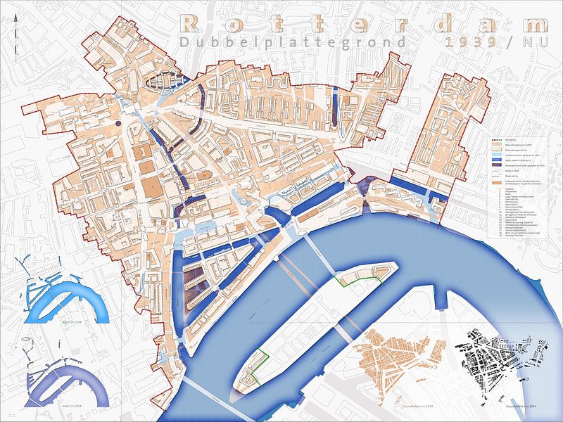
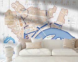
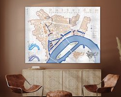
No city has changed so much over the last hundred years as Rotterdam. Already in the 1930's the city planners started making breakthroughs in the medieval center of the city. The German Luftwaffe did a more thorough job in 1940: in the bombing on the 14th of May, the old city was almost completely destroyed.
The Basic Plan for the Reconstruction by Cornelis van Traa laid the foundation for an entirely new city. The pre-war city was not rebuilt and the street plan was changed drastically, apart from a few important lines like Coolsingel, Goudsesingel and Binnenrotte. As a result, you can say that in Rotterdam there are in fact two cities, separated by time.
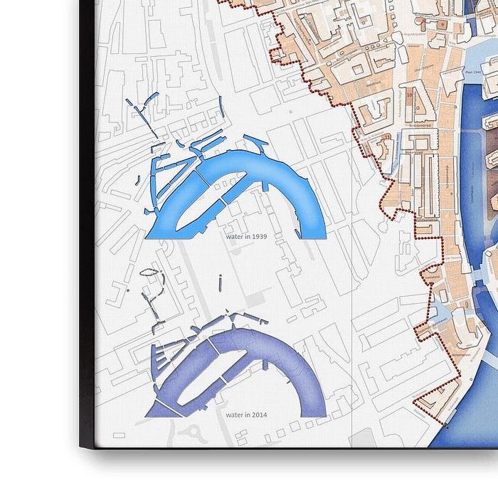
This double plan 1939/Now shows those two cities. The large blocks of modern Rotterdam are projected over the finely meshed pre-war town. Also the change in the watercourses is visible. The map also demonstrates how many old streetnames returned in the new city, although often on rather different locations.
The map includes the area within the fire limits of May 1940. Also the attachment points between the old and the new city are indicated the 19 buildings that not only survived the bombing but also the postwar demolition drive.

About Frans Blok - photos, art and other wall decoration
My work can be found in the border regions of photography, painting and computer visuals. With my company 3Develop I do work in commission but I use the same techniques, skills and software to make free work.
World maps and reliefs made from unique materials, vintage postcards,..
Read more…
 Graphics
 Illustrations
 Rotterdam
 Serene Peace
 The Netherlands
 Urban landscapes
 World and country maps
 Germany
 Ordered in August 2025
 Netherlands
 Ordered in July 2021
Netherlands
Ordered in July 2021
Netherlands Ordered in May 2023
Netherlands
Ordered in November 2023
Netherlands
Ordered in October 2024
Netherlands
Ordered in September 2017
Netherlands
Ordered in November 2024
Netherlands
Ordered in September 2025
Netherlands
Ordered in January 2017
Germany
Ordered in February 2024
Netherlands
Ordered in April 2020
Germany
Ordered in February 2021
Ordered in May 2023
Netherlands
Ordered in November 2023
Netherlands
Ordered in October 2024
Netherlands
Ordered in September 2017
Netherlands
Ordered in November 2024
Netherlands
Ordered in September 2025
Netherlands
Ordered in January 2017
Germany
Ordered in February 2024
Netherlands
Ordered in April 2020
Germany
Ordered in February 2021
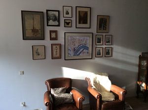
About the material
ArtFrame™
Interchangeable Art Prints
- High-quality print
- Easily interchangeable
- Acoustic function
- Large sizes available


Discover the artworks of Frans Blok - photos, art and other wall decoration
 One thousand wind turbine at seas - storm is comingFrans Blok - photos, art and other wall decoration
 Spherical panorama Rotterdam SkylineFrans Blok - photos, art and other wall decoration
 Veerhaven Rotterdam in WinterFrans Blok - photos, art and other wall decoration
 The Inverted WorldFrans Blok - photos, art and other wall decoration
 Old Harbour Rotterdam Around SunsetFrans Blok - photos, art and other wall decoration
 Panorama Coolhaven RotterdamFrans Blok - photos, art and other wall decoration
 Rotterdam: Sunset above the RiverFrans Blok - photos, art and other wall decoration
 Rotterdam Skyline, reflected in the river Nieuwe MaasFrans Blok - photos, art and other wall decoration
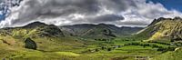 Panorama Lake District, EngelandFrans Blok - photos, art and other wall decoration
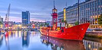 Panorama Wijnhaven RotterdamFrans Blok - photos, art and other wall decoration
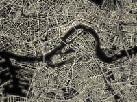 Light Map of RotterdamFrans Blok - photos, art and other wall decoration
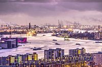 Rotterdam, the city, the river and the portFrans Blok - photos, art and other wall decoration
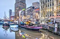 Rotterdam Wijnhaven, early morningFrans Blok - photos, art and other wall decoration
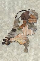 Scrapwood map of the NetherlandsFrans Blok - photos, art and other wall decoration
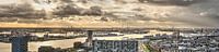 Port of Rotterdam PanoramaFrans Blok - photos, art and other wall decoration
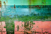 Colorful ship hull with draught marksFrans Blok - photos, art and other wall decoration
 Rotterdam skyline in greyscaleFrans Blok - photos, art and other wall decoration
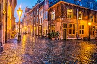 A rainy night in LeidenFrans Blok - photos, art and other wall decoration
 World map rust - black versionFrans Blok - photos, art and other wall decoration
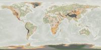 Japandi world mapFrans Blok - photos, art and other wall decoration


